


Product Details
+
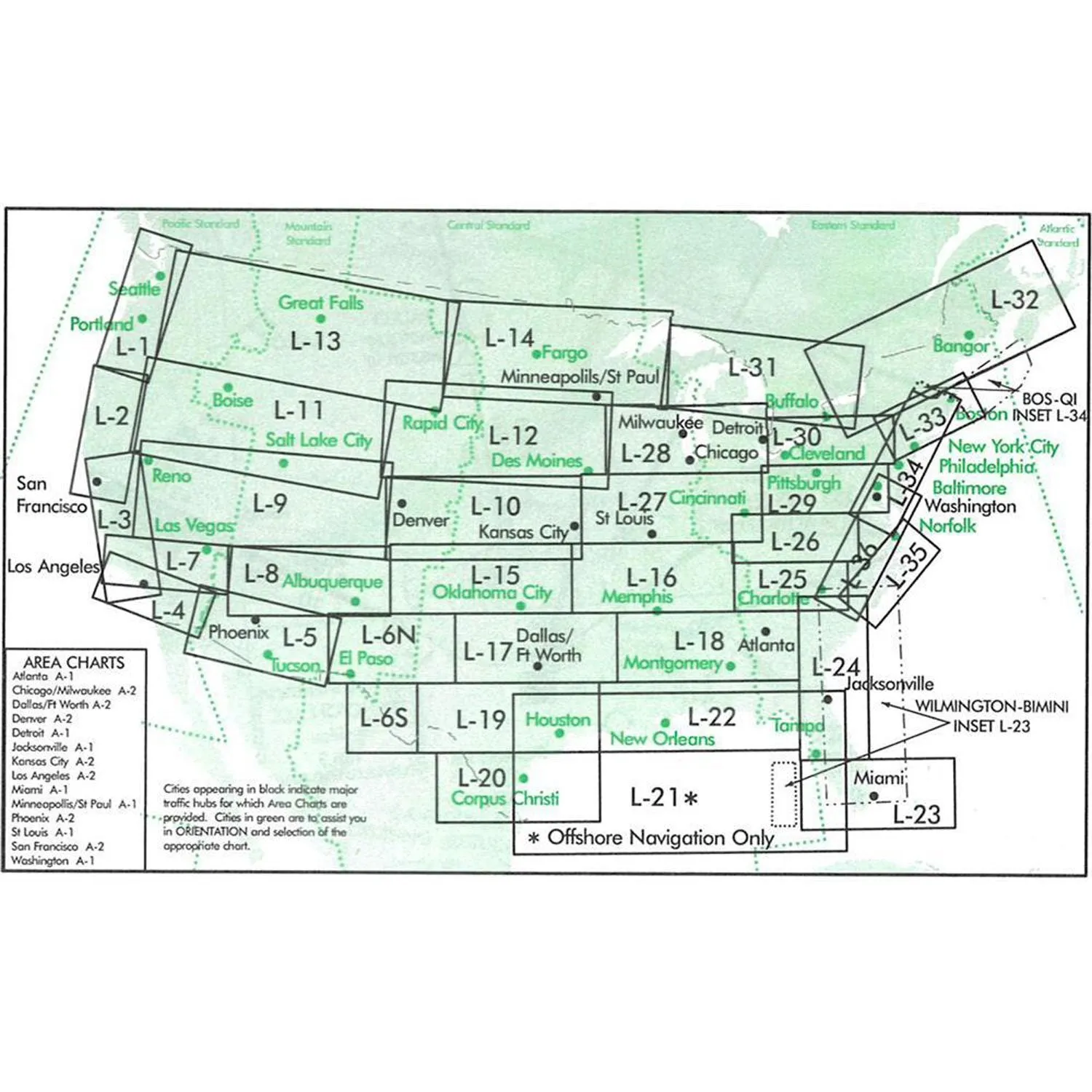
IFR Enroute Low Altitude Charts provide aeronautical information for navigation under instrument flight rules below 18,000 feet MSL. These four-color chart series includes:
- Air Traffic Services
- Airports that have an Instrument Approach Procedure or a minimum 3000' hard surface runway
- Airways/Route Data
- Cruising Altitudes
- Fixes/ATC Reporting Points
- Limits of controlled airspace
- Military Training Routes
- Off Route Obstruction Clearance Altitudes (OROCA)
- Radio aids to navigation
- RNAV Routes
- Special Use Airspace Areas
- Tabulations (MTRs, SUAs, MOAs, Airport data)
")
")


![Raymarine EV-100 Tiller Evolution Autopilot [T70153]](https://www.smartnavigat.shop/image/raymarine-ev-100-tiller-evolution-autopilot-t70153_kkvxNU_285x.webp "Raymarine EV-100 Tiller Evolution Autopilot [T70153]")


